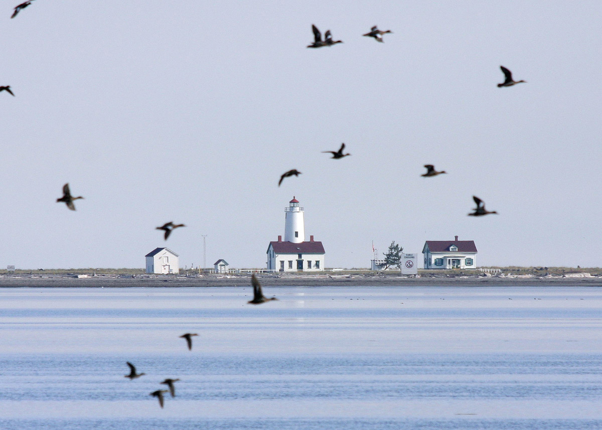
Marrowstone Point Lighthouse
 |
| Photo by: Cherri |
Extending from the base of
the bluffs on the northeast end of Marrowstone
Island is a low, level
piece of ground known as Marrowstone Point. The point was so named by Captain
George Vancouver for the soft clay visible in the bluffs above the
point. Eventually, the entire island became known by this name
The Marrowstone Point Lighthouse is located at the northern tip of Marrowstone Island
and forms the eastern entrance to Port
Townsend Bay. Here,
the main shipping channel is narrow, making navigation in north Puget Sound difficult and hazardous. Nearby shoals,
dangerous rocks, heavy rip-tides and persistent fogs influenced the Lighthouse
Board to reserve 10 acres on the point as lighthouse site in 1854, but it
wasn’t marked with a light until 1888.
Finally, after numerous accidents and
complaints from the shipping industry, the Lighthouse Service erected a post
lantern displaying a red light at a height of 15 feet on the most exposed part
of Marrowstone Point. The light was tended by a contract light keeper who rowed
to the point every few days to polish the lens, trim the wick, and replenish
the fuel supply. Mounted high on scaffolds, post lanterns had a drum-type lens that produced a bright fixed light. The lantern had a large tank encircling the top of the lens that held enough fuel for eight days.
Usually
post lanterns were used only until a more permanent structure could be built. However,
the Lighthouse Service didn’t get around to replacing the Marrowstone Point
light for 30 years.
A fog bell was added to the station in 1896, and a
one-and-a-half-story dwelling was constructed on the point to house Marrowstone
Point’s first station keeper, Osmond Hale Morgan, a sea captain, who came from
Whidbey Island with his
wife, Frances Elizabeth (Avery)
Morgan, and five children. In 1912, the light was placed on the small, concrete
structure.
Keeper Morgan served until
his passing in 1907, when Nettie E. Race, his daughter, was placed in charge of
the light and bell. Axel Rustad was appointed keeper in 1909, and he and his
wife, Karen, raised four sons on the point. Water for the station's inhabitants
consisted of rainfall that was stored in a 5,000-gallon, redwood tank, enclosed
in a shed behind the dwelling.
A woodshed and boathouse
were constructed at the station in 1898, and in 1902 a galvanized oil house and
a shelter for the lens lantern were added. The boathouse was moved away from
the shore in 1904 and converted into a barn.
Mariners complained that the fog bell
at the point was often inaudible, so a small, square cement building outfitted
with three large trumpets was put into service in 1918, solving the fog signal
problem. The light was eventually mounted on top of this fog signal building.
Shortly after the first
keeper took up residence at the station, construction of Fort Flagler
commenced on the bluff above. The fort was completed in 1907, and it became the
third active fort guarding Admiralty Inlet.
Together with the guns at Fort Casey on Admiralty Head and those at Fort Worden
near Point Wilson, the batteries at Fort Flagler
formed a "Triangle of Fire," to prevent hostile vessels from entering
Puget Sound.
Though automated in 1962,
the station still remains fairly intact. The station was transferred in 1972
from the Coast Guard to the Bureau of Sport Fisheries and Wildlife in the U.S.
Fish and Wildlife Service, for use as a scientific research facility. The keeper’s
dwelling now serves as a guest house for scientists visiting the
Marrowstone Marine Field Station and the short, squat structure housing the
lighthouse and fog signal still stands at the water's edge. Research in marine
ecosystem health and marine fish health is conducted at the station.
Fort Flagler
is now Fort Flagler State Park
and includes a military museum.
The Lighthouse Friends website has additional information about this site and some excellent information the island, the lighthouse keeper, Fort Flagler and some shipwrecks that occurred off the island. Here is a link to that site: http://www.lighthousefriends.com/light.asp?ID=109